
ALPR camera maps:
data, limits, and route checks.
An ALPR camera map shows publicly documented automatic license plate reader locations. RouteFrame adds route context by comparing real driving geometry with nearby DeFlock and OpenStreetMap records, while clearly separating documented evidence from missing data.
What is an ALPR camera?
An automatic license plate reader is a camera system designed to capture license plate identifiers from vehicular traffic. The OpenStreetMap ALPR documentation notes that systems may also collect vehicle characteristics and that ALPR equipment often uses features such as infrared imaging for low-light operation.
An ALPR camera location alone does not explain who can access the data, how long it is kept, or where it is shared. Those questions require operator policies, contracts, public records, and oversight documents. RouteFrame therefore treats map location, operator, and manufacturer as separate facts.
Where does the ALPR map data come from?
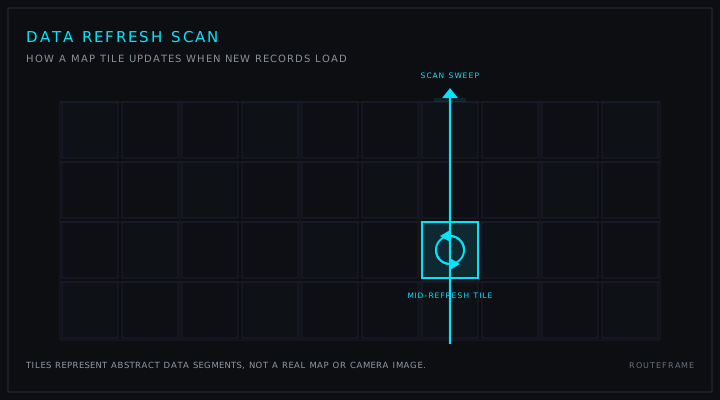
RouteFrame uses the official DeFlock project, which describes itself as a crowdsourced tool for locating and reporting ALPRs. DeFlock uses OpenStreetMap data for camera locations, types, and viewing direction. RouteFrame preloads the available national source snapshot, then requests a current geographic corridor when a route is selected.
The interactive map also queries DeFlock's public Overpass service for OpenStreetMap records tagged as video cameras or gunshot-detector microphones. Users can filter ALPR, video, and audio points independently. These broader layers do not alter the ALPR-only route-footprint calculation.
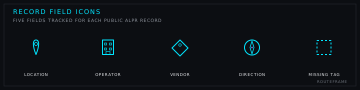
| Source field | Meaning | RouteFrame treatment |
|---|---|---|
| Location | Mapped camera coordinates | Shown as a clickable point linked to its OSM record |
| Operator | Documented organization operating the camera or controlling its images | Shown only when an operator tag exists |
| Manufacturer or brand | Equipment or platform vendor | Shown as vendor data, never as inferred ownership |
| Direction | Source-reported camera direction metadata | Shown as verified orientation only after an eligible source, method, review date, and confidence are recorded |
| Missing tag | Public source does not contain that field | Counted as missing coverage, not converted into a named category |
How RouteFrame checks a driving route
RouteFrame keeps route generation and ALPR evaluation separate so a public-data outage does not fabricate a safe result.
- Search deliberately.Location suggestions begin after four typed characters and a short pause, not on every keystroke. A deliberately submitted search can fall back to OpenStreetMap Nominatim.
- Choose exact matches.The user confirms the correct origin and destination instead of RouteFrame silently guessing among multiple places.
- Build normal routes.Project OSRM returns real driving alternatives, geometry, distance, duration, and turn steps.
- Load the corridor.The Cloudflare Worker requests DeFlock records around the returned route bounds and preserves source links.
- Measure proximity.Route geometry is divided into distance-weighted spans of no more than 50 meters. A span is marked near a public record when a loaded ALPR point falls within 55 meters.
- Measure record spacing.Matched records are projected onto the selected route geometry, ordered from the route start, and reported with along-route gaps. Contiguous matched spans become proximity zones, not prescribed reroutes.
- Try lower documented exposure.After the standard route loads, the user can request another driving route based on nearby loaded ALPR records. This preference does not certify a camera-free route.
What the nationwide county layer measures
The optional county layer downloads the current DeFlock regional ALPR cache and performs a point-in-polygon join against January 1, 2025 Census TIGERweb county-equivalent boundaries. It includes all 3,235 published county equivalents in the source boundary layer, including counties with no matched public record.
Color represents mapped-record count. The county receipt reports records per 100 land square miles and median nearest-record spacing when at least two points are available. These are source-availability measurements. They do not estimate camera field of view, road coverage, current operation, or the percentage of people observed.
What an ALPR camera map can and cannot prove
What RouteFrame can show
- Public ALPR records loaded near a route
- Source-linked mapped coordinates
- Documented operators and vendors
- Missing operator and vendor tag coverage
- Dataset snapshot and request-check times
- Normal driving route alternatives
- An optional lower documented-exposure driving preference
- Google Maps and Apple Maps driving handoffs
What RouteFrame cannot prove
- That every ALPR camera has been mapped
- That a missing point means no camera exists
- That vendor data identifies the owner
- That a route is private or camera-free
- That a person or vehicle will go unobserved
- That a camera is active at this moment
- That outside apps will preserve identical geometry
ALPR operator versus manufacturer
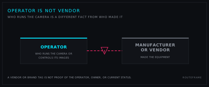
The OpenStreetMap surveillance guide defines the operator as the organization operating the cameras or controlling the images. Manufacturer and brand tags describe the equipment provider. A Motorola Solutions or Flock Safety vendor tag does not, by itself, identify a police department, municipality, homeowners association, or private owner.
RouteFrame reports operator-tag coverage and vendor-tag coverage separately. If a matched record contains only manufacturer data, the operator remains missing. This prevents a common data-quality mistake from becoming a false ownership claim.
How much does a Flock camera cost taxpayers?
There is no honest single price for every mapped camera. Public contracts can bundle hardware, software, cellular service, installation, maintenance, storage, search tools, support, and optional retention. RouteFrame therefore uses a visible, reproducible sample instead of claiming a nationwide total.
The five official city records below describe 151 cameras and $454,500 in recurring annual spending. That produces a weighted sample of about $3,010 per camera per year. It is a contract-spending estimate, not an exact invoice for any OpenStreetMap node and not Flock Safety's complete government revenue.
| Government | Annual figure | Cameras | Approximate annual figure per camera | Primary source |
|---|---|---|---|---|
| City of Palo Alto, California 20 Falcon subscriptions plus Advanced Search. | $52,500 | 20 | $2,625 | Official document, 2023 |
| City of Troy, Michigan 23 Falcon, 2 Falcon Flex, and Advanced Search. | $66,000 | 25 | $2,640 | Official document, 2023 |
| City of Lancaster, Texas 18 Falcon license plate readers. | $54,000 | 18 | $3,000 | Official document, 2024 |
| City of Mountain View, California Projected recurring cost after the first year for 24 cameras. | $80,000 | 24 | $3,333 | Official document, 2024 |
| City of Hayward, California Projected annual operation of the existing 64-camera network. | $202,000 | 64 | $3,156 | Official document, 2026 |
City of Hayward: the $202,000 figure above covers the existing 64-camera network only. A separate $392,560 figure in RouteFrame's procurement records covers that same network plus a proposed 30-camera expansion and one year of data retention. The two figures describe different scopes and are not directly comparable.
What to do when ALPR records appear near a route
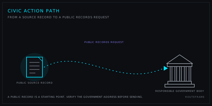
A public map is a starting point, not the final authority. Use the source record, then request authoritative information from the responsible city, town, agency, or private organization.
- Open the source. Check the OSM node, mapped tags, location, and update history.
- Separate evidence. Distinguish a documented operator from a vendor or visually identified brand.
- Ask for policy. Request locations, contracts, retention, access, sharing, audits, complaints, and corrective actions.
- Use public process. Find upcoming meetings, hearings, procurement votes, and public-comment opportunities.
- Document the response. Keep the tracking number, response deadline, produced records, and any denied portions.
After a route check, RouteFrame creates a ready-to-edit municipal transparency draft and helps find the official clerk or council contact. Verify the government address before sending.
ALPR camera map frequently asked questions
What is an ALPR camera?
An automatic license plate reader, or ALPR, is a camera system designed to capture license plate identifiers from passing vehicles. Some systems may also record vehicle characteristics such as color, make, or model. Storage, access, retention, and sharing rules depend on the operator and its policies.
Where does RouteFrame get ALPR camera locations?
RouteFrame loads DeFlock community records derived from OpenStreetMap. Each displayed record keeps its OpenStreetMap node source link. RouteFrame does not invent camera locations and does not treat a missing public record as proof that no camera exists.
Does an ALPR camera map show every license plate reader?
No. Public ALPR maps can be incomplete, stale, or incorrect because cameras may be unmapped, moved, removed, privately operated, or missing source tags. RouteFrame loads the available national source snapshot, refreshes selected route corridors, and shows source timing when available.
Can I filter video surveillance and audio sensors separately?
Yes. RouteFrame can filter public OpenStreetMap records tagged as video cameras or gunshot detectors, alongside DeFlock ALPR records. The filters change visible map points only. Route footprint statistics remain ALPR-specific, and missing records do not prove that no sensor exists.
What is the difference between an ALPR operator and vendor?
The operator is the organization responsible for operating the camera or controlling its images when that fact is documented. The vendor or manufacturer made the equipment or platform. RouteFrame keeps those fields separate and never infers ownership from a brand, location, or manufacturer tag.
How much does a Flock Safety camera cost a local government?
Five official city documents reviewed by RouteFrame describe 151 cameras and $454,500 in recurring annual public spending. The weighted sample is about $3,010 per camera per year, with a documented sample range of about $2,625 to $3,333. Bundles differ, so this is context rather than an exact price for a map node.
Can RouteFrame guarantee a private or camera-free route?
No. RouteFrame compares normal driving routes with public records near the route. A span labeled no ALPR record in loaded data means only that no loaded record fell within the 55 meter comparison corridor. It is not a privacy guarantee.
Does RouteFrame show ALPR record availability by county?
Yes. The optional United States county layer joins the current DeFlock ALPR snapshot to January 1, 2025 Census county-equivalent boundaries. It shows mapped-record counts, density per 100 land square miles, and median nearest-record spacing when at least two mapped points exist. A zero means no mapped record in that snapshot, not proof that a county has no cameras.
How does the simplified driving flow work?
Start typing an origin and destination, choose the correct location suggestions, and show the standard driving route. RouteFrame reports the loaded public ALPR records near that route. You can then request a route with lower documented exposure. Incomplete public records mean this is not a camera-free guarantee.
What can I do if public ALPR records appear near my route?
Open each source record, review documented operator and vendor tags, compare normal route alternatives, and contact the responsible municipality for authoritative policies and records. RouteFrame includes a draft requesting locations, contracts, retention rules, data sharing, audits, complaints, and public review.
Methodology and primary references
This guide was reviewed against the official DeFlock repository, the OpenStreetMap ALPR tagging guide, the OpenStreetMap surveillance guide, and the five linked primary municipal contract or staff-report documents. RouteFrame's 50 meter spans, 55 meter comparison corridor, and public-contract weighted average are product methodology, not claims made by DeFlock or OpenStreetMap.
Published: July 18, 2026. Last reviewed: July 22, 2026. Publisher: RouteFrame.